
La Línea
Work Zone
This writing arises from 2 journeys, 5 years apart, along the Mexico/US border, camping and exploring the segment from Organ Pipe National Monument Arizona to Eagle Pass Texas.
My mother was raised in Eagle Pass Texas and I’ve traveled there as long as I can remember. I've crossed the border there many times, and at Laredo, Matamoros, El Paso, Tijuana, and a few times by air, thus I’ve had the notion that I know the border. Perhaps I do, a little more than the average gringo, but it is a huge topic. It is worth noting that everywhere I have lived in my long life, Texas, California, and all the travel between, it was all once Mexico. Humans have lived in that area for millennia, since it was populated by megafauna (known to them as food & threat). Those first people trekked north & south carrying goods & ideas between their cultures.
When Spaniards landed on the Gulf of Mexico shore, and northern Europeans followed onto the shores of the Atlantic, the stage was set for the region to become a multicultural rift.
There are two aspects of the border between the United States of America and Los Estados Unidos Mexicanos. La Frontera is an area with blurry tendrils of cultural blending spreading deep into both nations. When I was a child my relatives used to say "Mexico begins at San Antonio".
The actual borderline is La Línea. The focus of this work is The Borderline, La Línea, seen mostly I must admit, from the northern side.
The cañon of the Rio Grande river at Langtry Texas
Along the borderline are twin cities, major avenues of commerce. Tijuana/San Diego, Nogales Arizona/Nogales Sonora, El Paso/Juarez, Del Rio/Ciudad Acuña, Eagle Pass/Piedras Negras, Laredo/Nuevo Laredo, Brownsville/Matamoros. At each of these major crossings masses of pedestrians & motorists pass daily. Trucks, & rail cars line up at customs. There are numerous smaller border twin village pairs scattered across that desert & river line. Airplanes carry passengers & freight north and south in the skies above.
The Tijuana metropolitan area, on the Pacific ocean, is the 5th largest in Mexico.
The Juárez Municipality has an estimated metropolitan population of 2.5 million people, the 8th largest in Mexico. With its sister city of El Paso Texas a combined population of over 3.4 million people straddles the Rio Grande. (These are rough numbers, varying in the ways & times they are counted.)
Entering the US from Piedras Negras, Coahuila into Eagle Pass, Texas after crossing the bridge over the Rio Grande .
The entire US/Mexico border stretches 1,954 miles total length, the 10th longest border in the world. On the US side Texas has the longest stretch of the border with Mexico, while California has the shortest. Among the states in Mexico, Chihuahua has the longest border with the U.S, while Nuevo León has the shortest.
The river marks 1,255 miles of La Linea, called Rio Grand on the U. S. side and Rio Bravo on the Mexican side -- the river great & strong. Interesting that both names are Spanish. The actual length of the river that forms the international border ranges from 889 to 1,248 miles (1,431 to 2,008 km), depending on how the river is measured. This is due to shifting channels, mostly in the last couple of hundred miles before it reaches the Gulf of Mexico. One notoriously disputed segment is in El Paso/Juarez, the Chamizal.
Great stretches of the river are wild, rugged and remote.
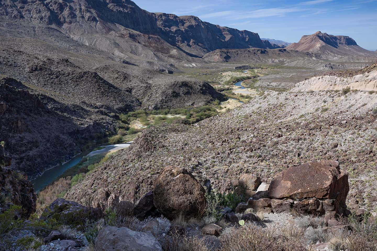
Here the river flows concealed in its riparian growth between cliffs.